Denali

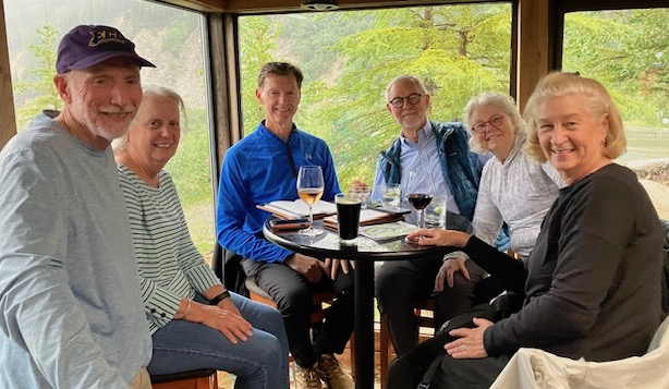
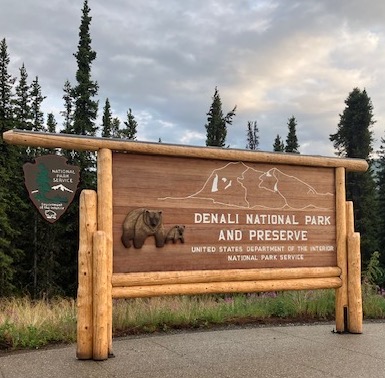
Probably a miracle, but every member of our group was on the Denali bus at 5:30 a.m.

(Photo Bill Pike)

Our driver gave us lots of information about park rules and regulations including how we were to handle ourselves on the bus.

The driver/guide was in constant chatter. This was mostly scripted, but with occasional personal comments.

Our bus (Photo Bill Pike)

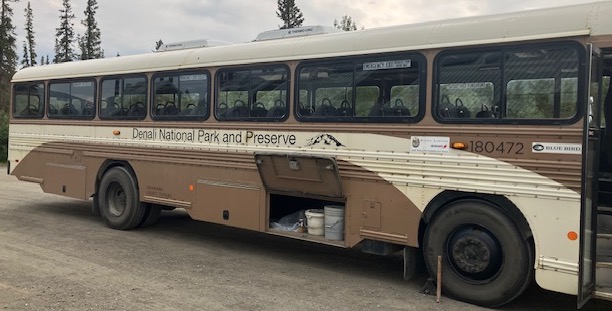
The bus was equipped with a camera that allowed the driver to zoom in on wildlife sightings. Flip down monitors were scattered throughout the bus.

These monitors allowed riders to see the wildlife that had been alertly spotted by a fellow passenger.

If a passenger shouted out animal, the bus came to a halt.

The passenger who made the sighting then described what he/she spotted and every eyeball on the bus focused on that speck of white. In this case it was a Dall sheep.

Binoculars and cameras with expensive lens were used to increase the chances of finding a moose having his antlers manicured at a Denali spa.

In truth, the bus’s exterior camera was excellent in picking a few of the finds made by passengers.

For me, the sightings of wildlife both real and doubtful became tiresome. Alaska has done a good job of marketing the state’s wildlife.

The well maintained road gave us clear views. (Photo Bill Pike)

However, the wildlife are coy about when and if they will make an appearance. One source I spoke with on the condition of anonymity stated that the wildlife aren’t pleased with their current contract.

Our five hour tour tallied no moose, one possible sighting of a bear—maybe a brown boulder, red squirrels, a hare, the state bird— the willow ptarmigan.

While on this tour, we received water, a box of snacks, and a nice booklet with excellent photos about Alaska.

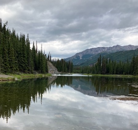
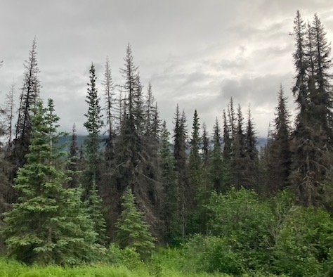
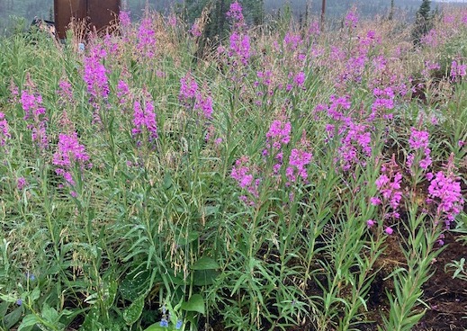
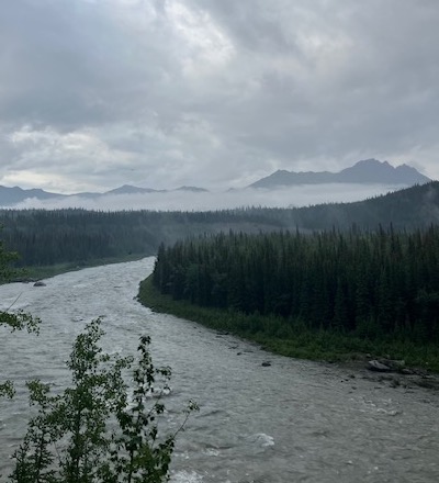
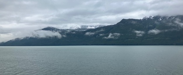
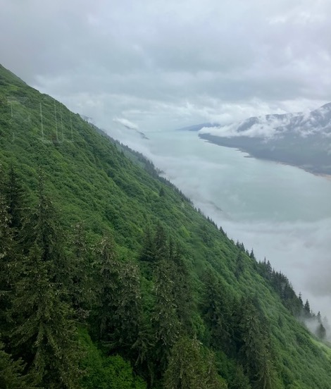
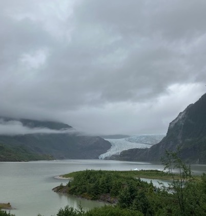
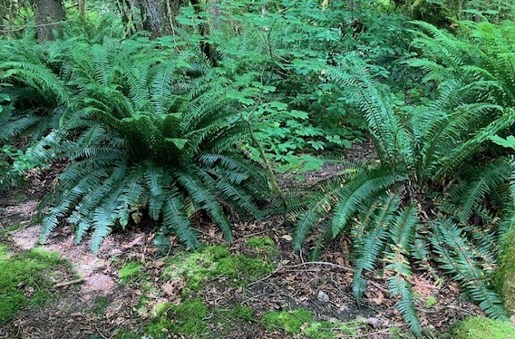
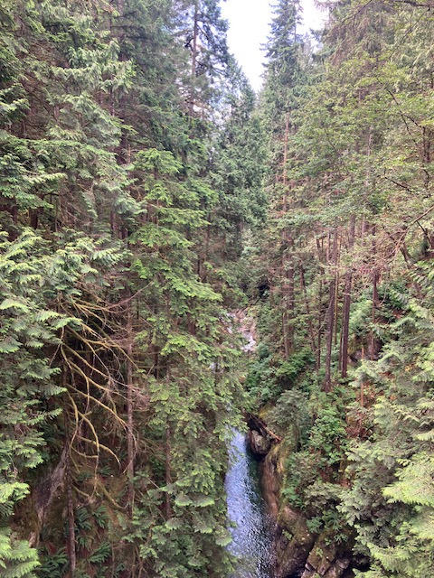
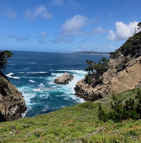
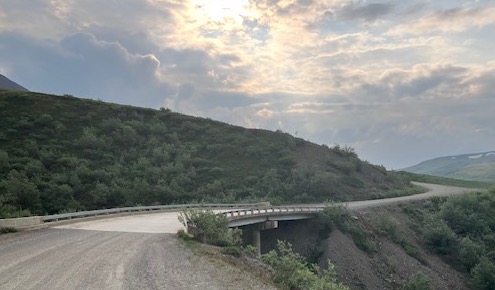
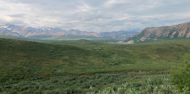
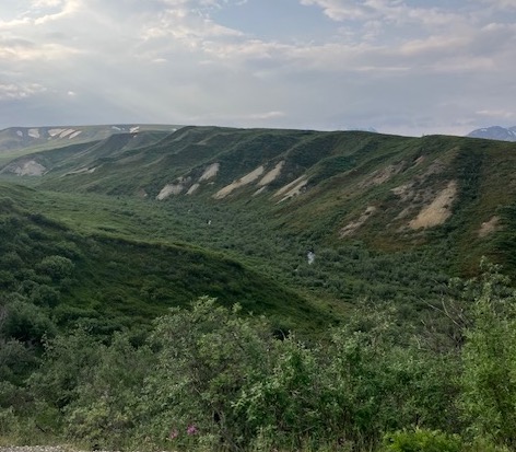
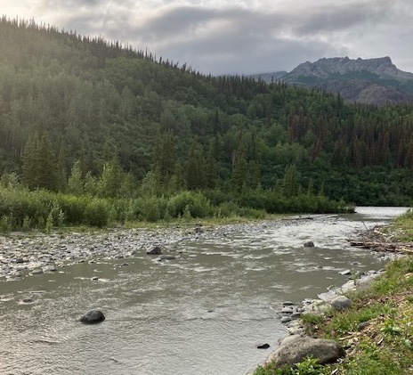
Again, the scarcity of wildlife sightings drew me more to the landscape. During our drive—permafrost, mountains, vast meadows, isolated ponds, a river, and rugged rock formations were all around us.

One of those clear views (Photo Bill Pike)

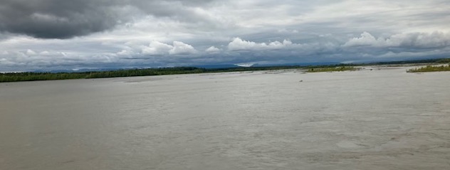
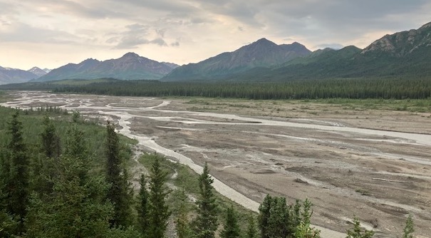
The Denali Park road crosses the Teklanika River. According to several sources, the Teklanika is a 91 mile long tributary of the Nenana River. Additionally, this section of the park features a popular campground with 53 sites for camping. The National Park Service manages the campground.

Teklanika River (Photo Bill Pike)

As far as the famous peak, Denali, the mountain was as bashful as the wildlife. Lots of clouds kept us from seeing Denali. Once again, a source I spoke with on the condition of anonymity stated that there is a tension between the cloud cover union representatives and the advisors representing the peak.

No matter the direction, the landscape was special. (Photo Bill Pike)

Overall, it was a good ride. However, I wonder if the five hours could have been compacted.

Our competent driver and guide deposited us safely back at the lobby. We took a break in our rooms, and then regrouped for lunch. Somehow, that ride had made us hungry.

After lunch, we check out a few shops.

My two wise friends (Photo Betsy Pike)

Then Betsy, Dan, and I took the free shuttle to the Horseshoe Lake Trail. It was here that we were rewarded—we saw a moose, a female moose, grazing in the shallows of the lake.

Our first moose sighting (Photo Betsy Pike)

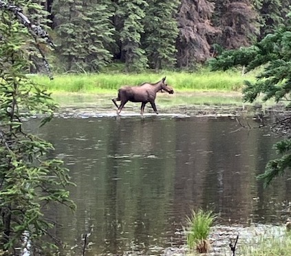
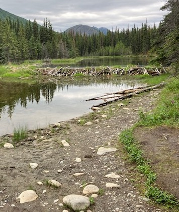
Luckily for us this moose, seemed to sense that she was a photo op for tourists. She stayed around munching for longer than tourists anxious for a real moose sighting deserved. Again, the trail and all that surrounded it are quite pretty including several beaver dams along the way.

Beaver dam (Photo Bill Pike)

From there, we caught the shuttle back to the Denali Visitors Center. This was a good spot for all information related to Denali. The place was packed.

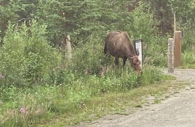
Just as our shuttle was leaving to take us back to the hotel, our alert driver spotted a moose casually munching on some weeds around one of the parking lots.

Our second moose (Photo Bill Pike)

Back at the hotel, we made a reservation for dinner and headed back to our rooms.

The Commander had picked up an annoying head cold. We weren’t surprised at this intrusion. No matter if we were on the ship, train, or bus we heard an assortment of coughs and sneezes.

In preparing for dinner, I was hoping to take a hot shower. Instead, I took a shower with a lousy temperature. At some point, Holland America must make some upgrades to this facility. It is starting to look a little weary.


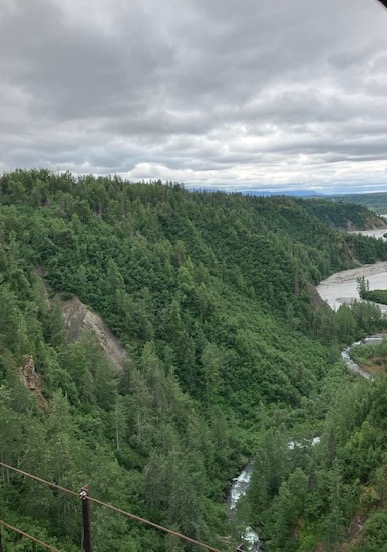
After dinner, we took two walks. First, a river walk behind the hotel that took in a variety of landscape plantings and the rapids of the river rushing by in the background. On two occasions, we saw rafters rolling by quickly.

River behind the hotel (Photo Bill Pike)

Our second walk, took us across the highway, and we walked the boardwalk of restaurants and shops that wanted our wallets. We obliged by purchasing some ice cream.

On the walk back across the highway, we figured out our departure plans for Wednesday morning.

We had to roll out early on Wednesday, but not at 5:30.

I’ve enjoyed this stop in Denali.

While it is true that the viewing of wildlife wasn’t as grand as advertised, and despite never having a clear view of the famous peak, Denali, I would not trade this stop for anything else.

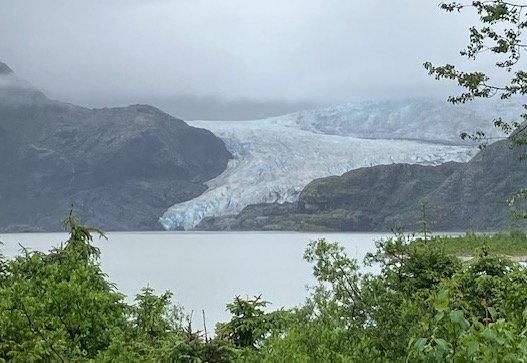
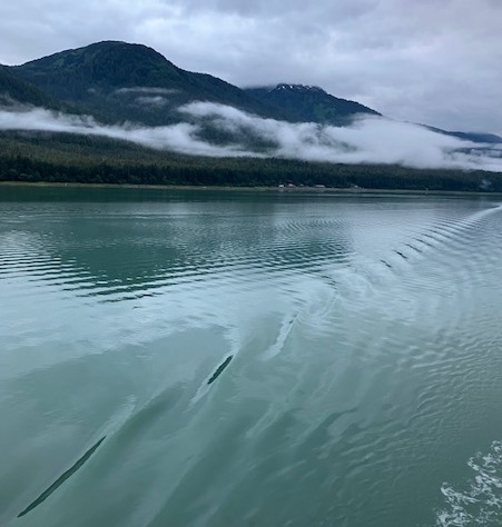
I’m sorry to be redundant, but the beauty of the land and the water makes up the difference.

Clearly, the good Lord’s angels were at their best when this precious land was carved out.

From the Horseshoe Lake Trail (Photo Bill Pike)

Anchorage to Denali

On Sunday evening, we made sure that we had properly tagged our bags for their 6:00 a.m. pickup on Monday.

Today, we travel by train on the McKinley Explorer for a little over seven hours to Denali. Once we are settled into our lodging in Denali, the Commander and I are scheduled to go out on a guided hike.

The train ride to Denali National Park was at times indescribable. Sure the occasional sightings of wildlife added to the journey, but in truth for me the best part of the train ride was the scenery.

One of the early water views from the train (Photo Bill Pike)

I could have taken a million photos. No matter where my eyes took me, no matter the terrain, didn’t matter if it included water views, mountains, vegetation— what I saw was stunning.

Rich forest along the way (Photo Bill Pike)

Added to that was the high quality of the train’s personnel who gave us local knowledge about where we were and what we were seeing.

A pretty view from the back of the train (Photo Bill Pike)

This quality of personnel also included the waitstaff, and yes, the kitchen staff. They were exceptionally gifted in providing hospitality. I wonder how the human resources department for Holland American finds these good people?

Our lunch in the dining car was an unexpected surprise. Quite simply, the food was delicious. The triple berry tart for dessert tempted me to have one every hour for the remainder of our trip.

Gradually, the train chugged into the Denali depot. There a bus picked us up and drove us to our lodging for the night. The Denali Lodge was owned and managed by Holland America.

As soon as we departed the bus and walked in the lobby, there was a massive power failure. Not what management or guests wanted or needed.

We found our rooms. Our luggage had already arrived. There was a bit of clumsiness with the power out, but we figured it out.

With our rooms secured, we regrouped at the bar.

Even with the chaos of the power outage, the staff kept their cool. Our waitress told us we would need to pay for drinks in cash, and that cold sandwiches were being provided for free. We ordered our drinks, and in a few minutes our sandwiches arrived.

My pals (Photo taken by our waitress)

Betsy and I had to be back in the lobby by 6:30 p.m. for our guided tour. We made it back without any trouble.

Eight people had signed up for the tour of the Oxbow Trail. Only six of us were present for the tour.

It was a cool, rainy evening, but the personality of our guide and his expertise made up for the conditions. Any reluctance we had to attend because of the weather conditions was quickly removed.

We learned so much about Denali and the trail we were walking.

Pretty flowers at the Visitor Center along the Oxbow Trail (Photo Bill Pike)

Our guide informed us about the twenty seven species of mosquitos that grace this part of Alaska. He also shared insights about the red squirrel’s habits, winter moose scat, the native trees, wildflowers, and the pretty north flowing Nenana River.

The Nenana River (Photo Bill Pike)

With regard to the power failure at The Denali Lodge, our guide told us that repairs can take time in this remote environment.

Often, linemen from the power company must travel two hours from Fairbanks to Denali. Despite this information, he was hopeful that luck might be on our side.

Our ride back to the Denali Lodge was pleasant as the Oxbow Trail had been a treat. I would recommend this 1.5 mile loop to anyone. Our guide gave us an insightful orientation to Denali.

Maybe, the travel gods were looking out for us. At some point after, 10:30 p.m. the power returned.

We had to be up early on Tuesday morning. We were all scheduled to take a five hour guided tour inside the Denali park. The tour started at 5:30 a.m. Our ride for the tour was to be a school bus.

Nothing like a train ride through stunning landscapes (Photo Bill Pike)

Juneau

I think my old body might be starting to adapt to the long span of daylight.

I think, I slept a little later this morning.

Although, I was up early, but maybe not as early as previous mornings.

The captain and crew are nudging the ship toward Alaska’s capital city, Juneau.

As we work our way toward the dock, I was greeted with by my usual shades of gray sky and gray water. But, that’s ok. There is still a stunning beauty in those shades.

A gray morning heading into Juneau (Photo Bill Pike)

Then slowly, the gray lifts ever so slightly, and the colors along the shoreline begin to appear.

A bit of color along the shoreline (Photo Bill Pike)

After breakfast today, we’ll be heading out to the Tongass National Forest. Our focus will be Nugget Falls, Mendenhall Lake, and Mendenhall Glacier.

From our location, we are about twelve miles away from the Mendenhall Glacier Visitor’s Center. The center was opened in 1962, and its dedication plaque contains these words: “To The Furtherance Of Knowledge And Enjoyment Of Glacial Phenomena.”

Clearly, there is lots to be learned and much to enjoy visually at this location.

We started with a two-mile round trip hike to capture a better view of Nugget Falls. With a measured length of 377 feet, the falls are spectacular. The sound of the water cascading down into Mendenhall Lake will clearly catch your attention. Another feature here is the beach. It allows visitors to roam toward the falls and the lake.

Nugget Falls (Photo Bill Pike)

As we start the walk back to the visitor’s center, there are numerous opportunities to enjoy the beauty around you. Just a few steps to your right or left shows the lushness of the greenery on either side of the trail.

A singular lupine (Photo Bill Pike)

Additionally, a sheltered viewing stand is available to look toward the Mendenhall Glacier. Even on this cloudy day, we are impressed with the depth of its mass as it winds back into the Mendenhall Valley. The glacier is 13.6 miles in length, and as you might guess, the glacier is receding.

Mendenhall Glacier (Photo Betsy Pike)

And one more tidbit, the glacier was originally named after the Auke Indians, but was renamed in 1892 to Mendenhall. This was in honor of Thomas Corwin Mendenhall.

Mr. Mendenhall was the Superintendent of the U.S. Coast and Geodetic Survey. Under his leadership, the international boundary of Southeast Alaska was surveyed. (US Forest Service/Tongass National Forest)

Soon, we were on our way back into Juneau.

We had lunch at the Twisted Fish. I enjoyed my perfectly grilled halibut sandwich and a well-made local Kolsch style beer. Noted on the menu were King Crab legs. A customer could order two legs for eighty dollars.

We spent the afternoon exploring Juneau.

There is lots of repetition among the shops with jewelry, t-shirts, and assorted trinkets dominating the store fronts.

We took a tram ride that was enjoyable. The cloud cover limited our view a bit.

View from tram (Photo Bill Pike)

Dating back to 1893, we came across the St. Nicholas Orthodox Church. The church has roots to the Russian Mission Society who supported its founding. Its octagonal shape and gold dome make it easy to spot, and in 1973, the church was placed on the U.S. National Register of Historic Places.

Historic church (Photo Bill Pike)

Our wandering continued as we worked our way down the stairs of a steep hillside heading toward the city’s waterfront park. Getting there we came upon a small Veterans memorial, spied a juvenile eagle a top a streetlight, and admired the statue of a life size whale leaping out of the water.

Whale statue (Photo Bill Pike)

Here we are in this pretty setting on the Gastineau Channel with the Canadian Coast Mountains overlooking the city, and just on the outer fringe of the waterfront park, we come across a singular encampment with a homeless person. Poverty has no boundaries. America, can’t we do better?

We continue our walk figuring out how to make it to the ship’s berth on the dock.

Once there, we re-enter, and then catch back up with our friends for dinner.

Seemed like we curtailed our post-dinner roaming this evening. Or maybe, the busy day, and the long daylight hours were catching up with us.

That bit of weariness seemed to be settling in on Marian. She wasn’t feeling well.

Before committing to sleep, I spent a few minutes out on our balcony. The local time was 9:30 p.m. I took a picture of the shoreline as we were departing Juneau. Back home in Richmond, it would be totally dark.

Ample daylight at 9:30 p.m. (Photo Bill Pike)

I really enjoyed our trip to the Mendenhall Glacier. Lots to take in between the energetic Nugget Falls, the placid Mendenhall Lake, with formidable, but shrinking glacier in the background.

I appreciate the respect that is being shown to preserve this precious land. I just hope we are wise enough to keep respecting and preserving it for our future generations.

My hope is tied to us always remembering the words on the plaque at the Mendenhall Glacier Visitor’s Center: “To The Furtherance Of Knowledge And Enjoyment Of Glacial Phenomena.”

One more peak at Mendenhall Glacier (Photo Bill Pike)

More Exploring Vancouver

We gathered for breakfast at 8:15.

However, it wasn’t long before our Uber arrived to drive us out to Lynn Canyon Park.

Vancouver has many options for tourists, but while you are visiting do not turn down the opportunity to visit Lynn Canyon Park. This is one special place.

You will take lots of pictures in Lynn Canyon (Photo Bill Pike)

For sure the highlight of the park is the suspension bridge, but that bridge is only part of the story. The park is stunning from the tops of its massive canopy of trees to water running through creek beds—visitors are in for a treat.

Magnificent trees (Photo Bill Pike)

The original suspension bridge dates back to 1912. That version of the bridge featured no railings to hold on to as a person passed over Lynn Creek. Not to worry, now the bridge has all the required safety features including hand railings.

Some of the cabling for the suspension bridge (Photo Bill Pike)

No matter where our feet took us on the well maintained trails, we saw nature at her best in this coastal temperate rain forest. A variety of trees, assorted mosses, large ferns, and unique birds make up the park.

Good growing environment for ferns (Photo Bill Pike)

At some point, the trail will bring you to the edge of a neighborhood, and you will want to make a stop at The End Of The Line General Store.

Looping back to our point of entry, the scenery did not disappoint us.

Waterfall (Photo Bill Pike)

From Lynn Canyon Park, we took a Uber to Queen Elizabeth Park.

Some of the well-maintained grounds at Queen Elizabeth Park (Photo Bill Pike)


Queen Elizabeth Park is 130 acres of more beauty. The park was formally dedicated in 1939 by King George VI.

The park offers much for visitors to see from the Arboretum, the Blodel Floral Conservatory, fountains/plazas, and statues.

One of the stunning flowers (Photo Bill Pike)

On this Saturday, the park was host to multiple weddings.

Additionally, we had the good fortune of eating lunch at the Seasons In The Park restaurant.

Back side of Seasons In The Park (Photo Bill Pike)

Back in April 1993, Bill Clinton and Boris Yeltsin dined here during the Vancouver Summit.

After lunch, we continued to explore the grounds. Again, no matter where we walked, we enjoyed the displays and the landscaping.

At some point, we requested an Uber.


The driver showed up in a Tesla. Nice car, but there was no way six adults were going to fit in this car comfortably.

Butch and I made the sacrifice and squeezed ourselves into the very back of the car. We were as tight in that space as vacuumed packed Vienna sausages in a can.

We laughed all the way back to the Hotel Sylvia. Maybe the laughter covered our fear. We knew if the driver made a mistake, this might be our last ride.

This was a beautiful day in Vancouver. Lots of people were out and about around the beaches and open vistas along English Bay.

We spent the remainder of the afternoon prepping for the transition to the ship on Sunday.

Before dinner at the hotel, some of us took a short walk along English Bay.

I loved my grilled halibut for dinner. Fresh and perfectly cooked, I’ll remember and miss this meal when I return to Virginia.

After dinner, with lots of others we were able to see a very pretty sunset.

That sunset (Photo Bill Pike)

Before drifting off, I thought about Boris Yeltsin and Bill Clinton dining at Seasons In The Park.

I wonder if the chef prepared a special dinner? Maybe Boris gifted Bill with a case of the best Russian vodka.

That was thirty two years ago.

Regrettably, America and Russia, still struggle

Too bad we can’t trust each other and become friends.

San Francisco Day Seven: The Seventeen Mile Drive and Point Lobos State Park

I was up early on the morning of Tuesday, May 13. My old body told me I needed to go for a run.

I followed this internal self-talk. I ran from the hotel to Otter Point in Pacific Grove. This is a part of the Monterey Bay Coastal Trail.

The trail had been dampened by some pre-dawn rain showers. That didn’t slow me or the other walkers, joggers, and bike riders who too were up early.

No matter where my eyes scanned, I had pretty views of the neighborhood and the bay. This run is not likely to leave my memory. The setting is too special. If I had the endurance and the time, I could have stayed on this trail all day. But another trail was calling me.

After breakfast, the Commander had us scheduled to start our exploration of the Seventeen Mile Drive. As much as I had liked the views from my run, the views for the remainder of the day would only become more incredible.

Much has been written about The Seventeen Mile Drive, I doubt I can add much to these praises. Let’s leave like this, if you are given the opportunity to make the drive, don’t turn it down.

I did not focus on the opulence of the homes or the famous golf courses. No, I focused on the determination of the Pacific Ocean, and the rugged coastline the ocean rolls into every minute of the day and night.

The Restless Sea (Photo Bill Pike)

Marker 4 on the drive is titled The Restless Sea, and here is the commentary about this section: “The Restless Sea earns its name as one of the most turbulent sections of coastline in Pebble Beach. Waves are constantly converging and crashing into each other, likely caused by submerged rocks.”

Each marker has a story to tell and a point to make. Perhaps the most famous is The Lone Cypress.

According to one marker, the Monterey cypress almost became extinct along the coast. Fortunately, it didn’t as the trees grow naturally here. The popular trees can reach heights up to seventy feet and can live up to three hundred years.

Yes, there is something special about The Lone Cypress. I admire its loyalty. No matter what nature has tossed at the tree, the cypress has remained loyal to its solitary perch.

The Lone Cypress (Photo Betsy Pike)

We made a short stop at the Pebble Beach Visitor Center. Next, we started working our way further south toward Point Lobos State Natural Reserve.

I’ll put this in the same category as The Seventeen Mile Drive—if you have the opportunity to visit Point Lobos, don’t turn the invitation down. Yes, you will walk more at Point Lobos, but those steps will reveal to you spectacular coastal scenery.

When we arrived at Point Lobos, the parking lot was full and closed. This meant we had to park along the shoulder of the highway that parallels the park.

We walked back to the entrance, took some advice from park personnel, and started our exploration. In truth, what happened was we were so enthralled by the beauty that we kept pushing ourselves further and further into the available trails.

One of many pretty sights at Point Lobos (Photo Bill Pike)

Eventually, we worked our way to a stopping point and the walk back to our car, but neither of us regrets taking the time to explore. What we saw was nature at her best.

The ocean, the rocky shoreline, the wildflowers, an occasional appearance of wildlife, and the knowledge of park personnel added to the pleasure of the hike. Neither of us will forget this visit.

Point Lobos: rocks, surf, flowers (Photo Bill Pike)

Back out on the highway, we made a stop in the parking lot of Monastery Beach and enjoyed our Pebble Beach sandwich in the car.

From there we drove back into Carmel By Sea for more exploring. The focus here was to locate some of the Storybook Houses.

Unfortunately, our interpretation of local maps was being challenged. Luckily, a patient, local resident sensed this, and he redirected our steps guiding us to our first Storybook House.

Carmel By The Sea Storybook House (Photo Betsy Pike)

We strolled through the shopping district and made our way down to see the famous beach. Even though it was May, a few beach worshippers were present on this pleasant sunny afternoon. In a few weeks, I imagine this beach will be packed.

Our walk back to the car revealed more about the character of the town.

A plaque on a fence featured these words in bold print: LIV DE LIFE with this Emerson quote behind it: “The ornament of a house is the friends who frequent it.”

Another creative sign featured precisely cut letters from assorted license plates to form this colorful expression: Happy Go Lucky.

Colorful sign (Photo Bill Pike)

From Carmel By The Sea, we re-entered The Seventeen Mile Drive from the land side. We worked our way to The Inn at Spanish Bay.

The Commander navigated us to a sunlit, stone patio where she ordered a glass of wine and I had glass of beer.

(Photo Betsy Pike)

We sat in comfort admiring the view.

Gradually, we inched our way back to the hotel.

After a respite, we walked back down to Cannery Row, and had dinner with a view of Monterey Bay at Louie Linguini.

Tonight, this trip was coming to an end.

Early tomorrow morning, we would say goodbye to this stunning California coastline and drive back to the San Francisco airport.

Thankfully, we survived the drive to the airport and the drop off of the rental car.

Inside our gate area, I stumbled upon a church friend, Susan King, who had been in San Francisco visiting a friend. Later she would get a good laugh watching me stuffing an over stuffed suitcase into an overhead bin.

Before we took off, the Captain of the plane for Breeze Airways gave what was maybe the best welcome aboard and here’s what to expect speech I’ve ever heard from a pilot.

Remnants of thundershowers were around the Richmond area as we descended into the landing pattern, but our landing was smooth.

We grabbed our bags and worked our way to the shuttle van to return us to our parked car.

The only downer of our trip unfolded between the driver of the van and an airline employee who admitted she had a lousy day.

These two individuals grumbled over where the airline employee wanted to be dropped off. The tenseness between them was disappointing.

This tiny confrontation brought me back to reality. That magnificent California coastline was far away on the other side of America.

I wonder if the personalities of the van driver and the airline employee could have been soothed by a single pretty California vista?

That’s hard to know, but I know that my old brain and soul will forever cherish what California shared with me and the Commander, the best trip planner in the world.

It might be hard to see it at times, and often we do our best to destroy it, but we still live in a beautiful world.

For that I am grateful, and I must constantly remind myself to do my part to take care of this world.

Another pretty vista from Point Lobos (Photo Bill Pike)

Grateful for Alaska’s outstretched hand

Letter to the Editor: Grateful for Alaska’s outstretched hand

JUNEAU EMPIRE
The Voice of Alaska’s Capital Since 1912
Wednesday, July 30, 2025

From June 29 to July 10, my wife, along with two couples from college, and I traveled into Alaska. Twelve days out from our indescribable trip, I’m still suffering from chowder withdrawal.


Even though Mr. Moose didn’t appear on every corner, Alaska captured us. No matter if we were on a ship, train, bus or foot, the landscape was spectacular.

Our views were enhanced from the knowledge of exceptional guides who expressed their love and respect for this cherished land. Their devotion made us appreciate even more the stories about the courage of the original settlers and their respect for their heritage.


And while Denali was shy, I had ample opportunities to appreciate other snowcapped peaks, rolling rivers, cascading falls, deep forests, and the stunning blue ice of glaciers.

In Fairbanks, from so many angles, the Museum of the North really captured the spirit of Alaska and its people. It is my hope that the people of Alaska will never lose their loyalty or will to always protect this precious and priceless land.

After an early morning run along the Chena River, some of us stopped at the statue of Walter Harper. I loved the simple beauty of his outstretched hand, a hand up ready to help no matter the person or circumstances. In the short amount of time I have left in this weary old world, I hope I will become better at following Walter Harper’s heart by outstretching my hand.

Thanks Alaska for outstretching your hands to us.

Bill Pike

Author’s note: I was honored to have my Letter to the Editor published in the July 30, 2025 edition of the Juneau Times.

Statue of Walter Harper (Photo Bill Pike)

San Francisco Day Five: Point Reyes to Monterey

After breakfast, we quickly gathered our belongings and headed toward checking out.

In the parking lot, the Commander Supreme made her final checks, and our journey to the Point Reyes National Seashore started.

We traveled the back roads of California toward the visitor’s center. Wisps of low clouds, lots of twists and turns, rolling hills with pretty land, and massive redwoods greeted us. Occasionally, we encountered brave bicycle riders on these narrow roads that offered very few straight sections for easy peddling.

Upon our arrival at the Bear Valley Visitor Center in the Point Reyes National Seashore, we were greeted by a few quietly grazing deer in the rolling pastures around the building.

(Photo Bill Pike)

The visitor center has extremely helpful national park employees. No matter your questions, these knowledgeable and patient staff have the answers.

The center also has a nice layout of effective displays giving visitors a glimpse of what they might encounter during their visit.

From the visitor center, our goal was to visit the historical Point Reyes Lighthouse. The ride to the lighthouse was remarkable.

I’m sure I will repeat myself, but no matter where our eyes took us, we were greeted with striking scenery.

I didn’t expect to see beef and dairy cattle grazing on this magnificent land. But occasionally, we’d come across a weather battered farmhouse with barns and out buildings scattered around. I wondered about the loneliness that might brew in this isolated beauty.

Some of the pastures on the way to Point Reyes (Photo Bill Pike)

If you travel this road, you will come across the historic KPH Radio building. Set off the road, you will walk a straight path lined on both sides with magnificent Monterey cypress trees. This tree-lined walk toward the building will never leave your memory.

The walk toward the KPH building. (Photo Bill Pike)

It’s not long before we reach the parking area for the lighthouse.

According to the National Park Service, the Point Reyes Headlands ‘jut ten miles out to sea.’ This probe out into the Pacific Ocean creates a potential nautical challenge for ships venturing north of San Francisco.

In 1870, this lighthouse was constructed to serve as a warning to ship captains and their crews. In 1975, the United States Coast Guard put to rest the first light. A new automated light was installed adjacent to the original lighthouse.

To truly encounter this magnificent lighthouse, visitors must descend 313 steps. This requires an alert patience in going down and coming back up, but the challenge of the walk is worth it. You will not want to stop taking pictures.

The walk down. (Photo Bill Pike)

Additionally, park rangers are on site to answer questions and guide you. It is worth a chat alone to hear about the extreme weather conditions that impact Point Reyes.

Fog to the south (Photo Bill Pike)

On the steps back to the parking lot, we paused a couple of times, caught our breath, and admired the view.

(Photo Bill Pike)

We regrouped in the parking lot, and from there we made stops at Chimney Rock, South Beach, and briefly explored a trail that were an ideal habitat for elk. And in each of those treks, wildflowers greeted us.

From a trail looking toward the Pacific. (Photo Bill Pike)

Again, I reminded myself of the people who had the vision and the will to preserve this priceless national park.

Land worth preserving. (Photo Bill Pike)

As we worked our way out of the national park, we stopped at the Tavern X Market for a sandwich. After lunch, I noticed the sign ‘Happy Trails’ hanging over the parking lot exit. Hopefully, the traffic gods would grant us ‘happy trails’ during the remainder of our afternoon driving toward Monterey.

Now following an interstate route, we skirted past Oakland. From a distance, we could see its attempts to re-invent itself, though graffiti was still a dominant nuisance in some stretches.

Occasionally, the traffic snarled with slow downs, but we kept moving.

The closer to Monterey, the more frequently we began to see the impact of farming on the outskirts of the Salinas Valley. But when we left the interstate, the farming communities really came into focus. Sure there was equipment, but I was more drawn to the richness of soil.

That soil reminded me of deep shades of chocolate and roasted coffee beans contrasted with healthy rows of green. Those fields were a tribute to the artistry of the farmers and their farmhands who year after year grow our nutrition.

Approaching the city limits of Monterey, the waters of the Pacific changed the backdrop.

It was Sunday afternoon, Mother’s Day, Monterey was still restless.

Our hotel on a side street in the city came into view.

We checked in.

Friendly staff at the front desk, guided our footsteps toward the Alvarado Street Brewery for dinner.

The walk back in the cool coastal air prepped us for our collapse and sleep.